|
 The
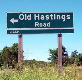
Old Hastings The
Old Hastings
Colonization
Road
Eastern Ontario
ghost towns
are a trip into the past
by Peter Young
Settlers to Canada in the 1850s would
often leave their homeland with a tear in their eye as they
bade their families and friends farewell. With Patrick and
Dermot Kavanaugh, circumstances were likely somewhat different.
Forced from Ireland’s troubled County Wexford with a
price on their heads, the youths escaped what might have been
an unpleasant and very short future by hopping aboard a sailing
vessel bound for Canada.
Patrick and “Darby” arrived
in North Hastings in 1856 via the newly constructed Hastings
Colonization Road, one of a series of routes built in Upper
Canada (Ontario) to encourage settlers to move northward into
the central region of the province. Within months Patrick
cleared land and began homesteading.
Not Darby. This Irishman was a born
entrepreneur who enjoyed business and the company of people,
and thanks to his strong will, the town of Umphraville (now
spelled Umfraville) became one of the busiest and most populated
centres along Hastings Road.
Darby established the Umphraville
Post Office which soon expanded into a full business centre
dealing in practically every commodity and service required
by settlers. Cash in the early days was not the usual means
of payment; rather, the barter system was more practical.
Darby accepted goods for trade. These items would be sold
or traded to others. He kept tabs running for years, accepting
his customers’ promises to pay by a certain date. As
a middleman he would acquire products such as a team of oxen
for a customer, or collect funds for his priest and church.
Darby even dabbled in money-lending for people to travel to
southern towns such as Madoc or Belleville. Interest rates
ranged from seven to 10 percent.
Darby Kavanaugh’s post office,
store and hotel made Umphraville a popular spot to stop along
the Hastings Road, providing supplies to lumber mills, and
lodgings to teamsters as they made their way to the camps.
Today the once-thriving hamlet of
Umphraville is marked only by a single sign pointing to the
pioneer cemetery located west of the Old Hastings Road. The
town that once boasted 260 residents is completely removed
from the map. Not so much as a dilapidated shack remains,
which might at least have given the village “ghost town”
status.
What happened to Umphraville? To
Thanet? To Murphy Corners? To Glanmire?
These once-busy towns, with stores,
hotels and mills along the Old Hastings Road, have simply
disappeared.
The Old Hastings Colonization Road
may conjure up romantic Canadian images of farm families industriously
creating new lives for themselves in the wilderness. But in
reality, this route was the “Trail of Broken Hearts”—a
label given to this colonization road by Ontario Land Surveyor
C.F. Alysworth in 1925. After traveling the entire length
of the route from Madoc north to the Madawaska River, he found
less than 25 percent of the original land grants still occupied.
From a peak of 400 settled lots in the late 1800s, fewer than
75 were being worked at the time of his inspection. Fields
were overgrown and buildings stood vacant, the products of
decades of pioneer sweat and toil slowly reclaimed by nature.
Today there is little to remind
us of those who came before us to carve their life out of
dense bush, swamps and Pre-Cambrian rock. The only physical
evidence left from these early settlers along the Old Hastings
Road are hints of their presence—a fallen moss-covered
split-rail fence, the form of an old cellar hole now sprouting
trees and bushes, or perhaps a pile of boulders cleared, more
than a century ago, to make room for what was hoped to be
an abundant harvest.
Between Millbridge and Bancroft
a number of bustling communities sprouted along the Hastings
Road in the latter part of the 1800s, but alas, these hamlets
are long gone with names found only in local history books.
But if you enjoy traveling the back routes on a quiet summer
or autumn day, you can visit these sites, close your eyes,
and imagine the school bell calling children back from recess,
the clip-clop of horse hooves pulling supply wagons, and laughter
drifting from the hotel’s open door.
Before we grab the camera, put on
our hiking boots and explore the locations of these “ghost
towns,” let’s take a look at the history of the
Old Hastings Road—a trail considered one of the “most
challenging thoroughfares ever built in southern Ontario.”
By 1850 in Ontario most of the good
arable land to the south was cleared and occupied. Most people
at the time lived in the country and farmed; in fact, before
1900, three of every four people lived on farms or in rural
communities. New immigrants were arriving from Europe eager
to own property. They had been pushed from their homeland
for a number of reasons, including the potato famine in Ireland,
political unrest, and a rise in population in some countries
which made it very difficult for some families to survive.
These new Canadians, along with sons of Upper Canada farmers
looking for their own land to till, placed a heavy demand
on farmland.
In response to this need for new
land to cultivate, Upper Canada passed the Public Lands Tract
in 1853. Funds were set aside to build colonization roads,
and free land grants were given to settlers 18-years and older
on the condition that, within four years, they cleared 12
acres, built a house of 18’ x 20’ (some sources
say 20’ x 23’), and promised to maintain their section
of the road.
However, before lots could be surveyed,
cleared and settled, access to the interior of the province
had to be established through a network of colonization roads.
The Hastings Colonization Road was one of a series of north-south
and east-west routes built between Ottawa and Georgian Bay.
In 1851, a Belleville surveyor with
the distinctive name of Publius V. Elmore was assigned the
project of running an exploratory line from Madoc to near
what is now the southern tip of Algonquin Park. Three years
later, Robert Bird, of Sidney Township, was instructed to
open a road on Elmore’s line which, when completed, would
form the north and south boundaries between a series of North
Hastings Townships. Fifty-acre lots were surveyed on either
side of the Hastings Road through these townships. The Hastings
Road Agency was given the responsibility of building the road;
construction was contracted to George Neilson from Belleville,
who sub-contracted the work to Madoc farmers Cook and St.
Charles to begin construction in 1855. The first 40 miles
(64 kilometres) were built for 125 pounds per mile.
The road could have been laid down
over crystalline limestone to obtain a level course, (according
to Memoir #6, Geology of the Haliburton and Bancroft Areas—Geological
Surveys Branch, Department of Mines, 1910), but instead a
line was drawn on a map, and orders were given to lay out
a road along this line. The route held its course regardless
of hill or valley, and ran through very rough country—this
could have been avoided had the road been located slightly
to the east. And as the lots were laid out, a mathematical
grid pattern was used—rather than thought being given
to the quality of the land—resulting in many of the land
grants being rocky, swampy or both, and not suitable for farming.
The agent in charge of securing
settlers for the road, M.P. Hayes, later complained this trail
crossed hills at right angles; “it may be said to be
a continual succession of steep hills and crosswayed gullies....”
The completed road went north from Madoc, running 16 degrees
west, with a change of direction to the east at L’Amable
Lake, and ended 100 miles later at the Opeongo Colonization
Road.
On July 18, 1856, Hayes opened his
Hastings Road Agency office in Madoc. The company had annexed
close to 1.2 million acres of land in the townships of Hastings,
claiming that 900,000 acres were suitable for agriculture
and would be divided into 100-acre farm lots. A few years
later, an 1863 official map, published by the Commissioner
of Crown Lands, indicated 40 percent of the whole county was
suitable for farming. Interestingly, one hundred years later,
a 1962 soil report states less than 150,000 acres could be
used for agriculture, a figure closer to 12.5 percent. Many
surveyors and land agents of the time sent in optimistic reports
on land use but knew very well that most of the land could
not sustain farming operations. It was lumber companies, desperately
wanting access to the forests of central Ontario, that pushed
for the completion of colonization roads.
Between 1856 and 1863, more than
1000 people followed the footsteps of early settlers such
as the Kavanaughs to carve out a new life in Ontario’s
wilderness. This land was attractively marketed to potential
homesteaders as an area with an abundant water supply, falls
of water with potential to supply power for manufacturing,
and superior heavy timber that could be sold and burned for
potash—a commodity in demand at the time. The pioneers
were told, once cleared, the land could be used for growing
crops such as wheat.
By early 1858 Hayes reported statistics
to his Commissioner indicating the total population was 683,
there were 144 lots settled, 1200 acres were under cultivation,
and 187 buildings were erected. The report also stated that
during April the Hastings Road was almost impassable.
Indeed, travel on the Hastings Road
was easiest during the winter when wetlands froze, pot holes
filled, and sleigh runners could glide along terrain that,
during the rest of the year, offered a slow, bone-jarring
trek. Even springs on wagon seats provided little protection
against the rough trail.
Hayes told his Commissioner that
transportation on his road was twice the cost of the other
Free Grant roads and the cost of maintaining this trail was
more than the settlers could afford. More government money
was allocated to improve the road in 1865 and in the years
following. Much of the work was done by Darby Kavanaugh and
men he hired. Even though some sections were re-routed, a
geologist at the turn of the century wrote that the road was
constructed through the county’s roughest country, “interesting
to a geologist, but presenting difficulties to the settler.”
Figures in 1863 show a growth pattern
along the road. A population of 1031 had cleared 5,370 acres,
and constructed 580 buildings. But as optimistic as these
numbers may be, they do not give a true picture of the sweat,
toil and frustration experienced by the settlers.
Unlike the rich agricultural southern
part of the province which had been systematically developed,
people had to search for small patches of tillable farmland
in the central region. Often the forest camouflaged marginal
farmland. Pioneers believed that by clearing the land of trees,
crops would thrive afterwards. Therefore, lumbering was looked
upon as a forerunner of a more important industry—agriculture.
Strenuous, difficult, heartbreaking—these
words all describe pioneer life. Fields had to be cleared,
seeds were sown by hand, and the limited selection of machinery
available at the time continually broke down. Blackflies and
mosquitoes were at times unbearable, considering that one
had to work outside every day. Pioneers combated many things
from bush fires, to birds and animals eating the small crops,
to natural misfortunes such as drought and hail.
Self-sufficiency was the goal that
all homesteaders aimed to achieve; this meant devoting efforts
in a variety of areas. Hay and grain were hand-cut, clothes
were knitted, and soap came from leaching hardwood ashes.
Maple trees were a godsend for syrup and sugar. But although
a few successful farms on deeper soil lured others to Hastings
County, it became nearly impossible to make a living from
farming alone, and most settlers had to engage in another
activity such as logging.
Lumbering was the main industry
in the region between 1850 and 1900. Farmers turned to this
type of work in the winter, cutting logs and skidding them
by oxen and horses to rivers and lakes when the spring log
drive would send timber to its final destination: the Ottawa
River. Lumber camps also provided a market for farmers to
sell some of their products including potatoes, oats and hay.
By 1880, farmers began to see that lumbering had a limited
duration. Logging—one of the main activities that supplemented
farmers’ incomes—was seasonal and risky, especially
as resources became somewhat depleted.
Though women were often the source
of stability and courage in pioneer families no woman’s
name appears on any records of the Hastings Road until 1874
when Elizabeth Neal located in Faraday Township. As Nila Reynolds
points out in her book, Bancroft—A Bonanza of Memories,
“women nursed the sick, tended the dying, prepared the
dead for burial, and acted as midwives; they worked beside
their husbands much of the time, kept the house under terrible
conditions of cramped space and extremes of heat and cold,
and oiled the very machinery of life itself with their tenderness
and compassion, ignoring slow years robbing them of the nameless
grace that never comes again.” Women tended to develop
a fatalistic attitude to their life—“If I’m
meant to live, I’ll live, if I’m to die, I’ll
die.”
By the latter part of the 1800s,
farmers realized they were not going to make a living from
the land along the Hastings Road—or along many of the
other colonization roads in central Ontario. By 1900 the futility
of farming this area, combined with the opening of Canada’s
west, with its fertile soil that needed little clearing, led
to an exodus of settlers from the Hastings area. This pattern
was normal throughout the southern Ontario portion of the
Pre-Cambrian Shield in the early 1900s. Without new settlers
replacing those leaving, the population actually declined
in most North Hastings townships in the first decade of this
century.
Prospectors were moving into the
area though. They staked claims they hoped would be abundant
in mineral deposits. Mining did develop into a large industry
in the Bancroft region, but still presented similar problems
encountered in logging—after the resource was mined,
the demand for settlers’ products and labour to service
the facility also dried up.
Towns along the Old Hastings Road
were not abandoned overnight. The process was gradual as various
services and industries closed down. Gristmills ceased to
operate when wheat farming declined. Rail lines, once busy
servicing lumbering and mining operations, closed. Hotels
were boarded up as the temperance movement succeeded in stopping
liquor sales. By the 1900s Ontario had entered its urbanization
phase, and many people from small hamlets who had not moved
out west drifted to larger centres. This movement led to highways
being built, often bypassing what remained of the villages.
The present Highway 62 follows much
of the original Hastings Road at both the southern and northern
ends, but it is the central section, about 50 kilometres (30
miles), that witnessed partial to complete abandonment. Along
this stretch, between Millbridge and Bancroft, the villages
of Glanmire, Murphy Corners, Thanet, Ormsby, and Umphraville
struggled for life and identity. However, except for a few
dwellings which mark the crossroads of Ormsby, the fight for
a permanent place on the map of Ontario was in vain.
But to forget these hamlets and,
more importantly, the people who braved almost impossible
odds to create a new life for themselves, would be doing a
great disservice to them and their descendants, many of whom
still live in the Bancroft area.
Ron Brown’s book Ghost Towns
of Ontario briefly describes these villages. The remains
of Glanmire, once a thriving centre with a school, church,
post office, hotel, mill, and houses, can still be found 10
kilometres (6 miles) north of Millbridge. Originally called
Beaver Creek, and then Jelly’s Rapids, Glanmire’s
post office opened in 1858 by James Richardson. St. Margaret’s
Anglican Church was erected in 1887, but all that remains
today are the front steps leading to a monument indicating
the congregation worshipped here “faithfully for over
seventy years.” In the early days, a United Empire Loyalist,
Isaac Stymers, carried the mail on foot from Jelly’s
Rapids to York River. During the 1870s the meagre prosperity
of the Hastings Road showed signs of decline, and Glanmire
felt the effects. As with most of these population centres,
the buildings have long ago disappeared, but just north of
the cement bridge crossing Beaver Creek, the cemetery headstones
in the St. Margaret’s churchyard remain. It is at Glanmire
that the fully serviced Hastings Road ends and becomes a seasonal
road, but remains passable during the summer.
The road improves a few miles north
at Murphy Corners, just west of Steenburg Lake. In the old
days, Murphy Corners—settled by brothers James and Pat
Murphy—was the mill town, and the village of Thanet was
the stopping place. In 1860 a school was built in Murphy Corners
with a church following 10 years later. The original Murphy
log homestead, still being used as a seasonal residence, can
be seen at the northeast corner of the crossroads. Church
services were conducted in this cabin until the new building
was constructed.
Although only a small cemetery now
marks the location of Thanet, 2.5 kilometres (1.5 miles) north
of Murphy Corners, three hotels once offered food, lodging
and plenty of drink to customers. One of the establishments
here, known as “Thwaites Place,” had a reputation
for the latter throughout the county.
Travelling north for another 7 kilometres
(just over 4 miles) brings you to Ormsby, located at the intersection
of the Hastings Road and Highway 620. By the 1880s a railroad
traveled from Picton through Trenton to Coe Hill, making Ormsby,
where the railway crossed the Hastings Road, the most important
railroad depot in North Hastings County. This prominence was
short-lived after the Central Ontario railway pushed north,
with its main line bypassing Ormsby, dashing the residents’
hope of making Ormsby a significant centre. An Old Hastings
Colonization Road Historic Site marker is located at this
intersection.
The final ghost town along the trail
is Umphraville, 16 kilometres (about 10 miles) north of Ormsby.
Umphraville was perhaps the most important of these pioneer
settlements, mainly due to the water power facility on Egan
Creek, which gave this hamlet more growth advantages than
other centres. Along with the enterprising Darby Kavanaugh,
other individuals tried to make a living with their businesses.
In 1860 William Jorman built a flour mill and sawmill, and
Benjamin and William Spurr opened a general store. The store
lasted until late 1890s, but other services closed down shortly
after they began. As with Glanmire and Thanet, the only enduring
mark of Umphraville may be seen in the graveyard, located
along a gravel trail about one kilometre west of the Old Hastings
Road. Some of Umphraville’s early settlers are buried
here, including Bridgeta Cavanaugh (with a ‘C’),
wife of Patrick, who passed away in 1887.
In 1897, Darby sold 600 acres of
land and moved into Bancroft where he bought a dry goods store,
later selling it to his son, Thomas. By this time Umphraville
had seen its best days. At one point, around 1892, it outdid
rival Bancroft in population (260 to Bancroft’s 250),
but with only one general store and one flour mill, it quickly
fell behind the growing town of Bancroft with its five general
stores, three blacksmiths, a number of mills, a hotel—and
a doctor, too.
The Old Hastings Colonization Road
can perhaps best be described in a quote from the book, Historic
Hastings: “The Hastings Road is one long trail of
abandoned farms, adversity, blasted hopes, broken hearts,
and exhausted ambitions. The rugged countryside of Hastings
County has handicapped the surveyor, discouraged the farmer,
attracted the miner, rewarded the lumberman, and enchanted
the artist, sportsman, and vacationer.”
Indeed, our forefathers proved farming
in many parts of the county is impossible. Many of the tall
pine forests that once carpeted the region were logged out
long ago, and mining activity is at a standstill. Yet there
is a magic in Hastings that not only urges locals to plant
their feet firmly on the ground, but also attracts visitors
year-round, even coaxing some people to lift up stakes and
move here. Just what is this magic? Perhaps, as the quotation
suggests, it is this “rugged countryside”, or natural
beauty, that calls to people and whispers to us, “I cannot
be tamed, but I can be loved.”
BIBLIOGRAPHY
Brown, Ron (1978) Ghost Towns of Ontario, Stagecoach
Publishing Company
Cole, Jean Murray (1989) A History of the Township of Chandos,
Publisher—Municipality of the Township of Chandos
Langman, R.C. (1971) Patterns of Settlement in Southern
Ontario, McClelland and Stewart Limited
Reynolds, Nila (1979) Bancroft—A Bonanza of Memories,
Publisher—Bancroft Centennial Committee
This is an original story,
first published in The Country Connection Magazine,
Issue 47, Autumn 2004. Copyright Peter Young.
RETURN
TO STORY INDEX
RETURN
TO BACK ISSUE PAGE
To purchase this issue of The Country Connection, please send a cheque to:
Gus Zylstra, 691 Pinecrest Road, Boulter ON K0L 1G0, Canada
In Canada: $4.95 + 2.20 shipping + .93 HST = $8.08
In the USA:$4.95 + 3.80 shipping + 1.14 HST = $9.89
|