|
Madawaska Valley
Beginning at the aptly named Source Lake
in Algonquin Provincial Park, the mighty Madawaska River courses
down to the Ottawa River at Arnprior, some 225 kilometres
to the east. The spectacular Madawaska River cuts through
Renfrew County, gouging out deep gorges and widening out into
lakes along the way. Foaming white-water rapids and scenic
landscapes abound as the Madawaska drops 224 metres from its
source to its mouth. A natural vacation area, the Madawaska
Valley begs to be explored.
History at a Glance
11,000 to
8,000 BC—At the end of the ice age, the glaciers
began to retreat northward. Early Paleo-Indians were present
and lived by the abundant riches provided by the land. Artifacts
found from this era include large stone chips taken from rock
outcrops.
8,000 to
3,000 BC—Present-day plant and animal communities
were shaped. Indians adapted to the environment and created
tools from the many natural resources available. Constant
travel was essential for their survival.
3,000 to
1,500 BC—Recently found burial sites display increased
social behaviour and the creation of art and ceremonies. Seasonal
gatherings of tribes, refining of tools, and the use of copper
mark this period.
1,500 BC
to contact with Europeans—Numerous First Nations
settlements were established. Using canoes crafted from their
environment, the Nipissing, Ottawa, and Cree nations of northern
Ontario—and the Hurons and Iroquois to the south—developed
extensive trading systems. Artifacts were often made of ceramics
and clay.
The contact
period—By the 1600s, European trade goods appeared.
Trade with the Aboriginals flourished but caused disruption
and tribal wars. European diseases decimated the Native population.
The Recent Past
Since the end of the last ice age, water
has shaped the Madawaska Valley’s topography, flora and
fauna. The rushing meltwater from retreating glaciers shaped
today’s watershed in the form of valleys, hills, eskers,
kames, lowland flood plains, lakes and rivers; it would provide
important waterway routes for generations of Aboriginal peoples,
mainly the Algonquins of eastern Ontario. European explorers,
using Algonquin-made canoes, would also navigate these routes
to lead them from Quebec City to Georgian Bay and beyond.
The Madawaska River and its tributaries allowed smooth passage
between the Ottawa River to the east and the highlands of
today’s Algonquin Provincial Park.
The Native peoples made a good life, despite
the harsh climate and rough terrain. They were masters of
living in harmony with nature. Heights of land throughout
the watershed offered them strategic defense. Lowlands and
marshes yielded natural crops such as wild rice and berries.
Harvesting from the wilderness, they were the last to truly
co-exist with their surroundings. The earliest European explorers
adopted these Native traditions as a means to survive and
finally settle in a strange land.
The explorers would soon learn that to
tame these wild lands they needed to understand the waterways
as did the Aboriginal peoples. The first maps of Upper Canada
included only settlements, lakes and rivers. Timber and trade
goods would eventually traverse the seas to the markets of
England and France. It would take several generations for
their reliance on the rivers to diminish.
As European settlers colonized Upper Canada,
they brought their own traditions with them. They cut rough
roads that would lead them deeper into the forest in search
of timber, minerals, and agricultural lands. These early roads,
merely widened paths, were unsuitable for the safe passage
of goods and people.
By the mid-1800s, a system of colonization
roads, funded by the government, paved the way for greater
prosperity for the growing influx of immigrants. Improved
technology and engineering led to the construction of better
roads capable of withstanding the harsh climate and heavy
loads. The foundation for today’s roadways was now in
place, leading settlers to friendlier terrain and newly found
riches, fueling the wheels of progress for future generations.
River travel by boat and canoe had now
been replaced by the horse and buggy, soon to be followed
by the automobile. Rather than harmonizing with the environment,
the settlers modified the environment to suit their lifestyle.
The rivers and lakes that opened up this country became secondary
to the settlers’ quest for progress. As the First Nations
population dwindled or was relocated to reserves, the Native
guides and their ecological lessons would be relegated to
the history books forever.
The Early Roads
The first roads were strategically laid
out to connect far away places for many reasons: For military
travel, to access diminishing stands of timber, to find better
agricultural lands and to carry goods to newly created—and
sometimes booming—settlements. Remnants of these colonization
roads are still visible today, and can be seen following some
of our modern highways and back roads throughout the Madawaska
Valley.
Today’s roads highlighted on these
maps will lead the modern-day explorer to small communities
throughout the Madawaska Valley, where bits of the past can
be found in museums, abandoned homesteads, railway stations
and settlements along the way.
The Ottawa and Opeongo Road
Originally created to open up the Ontario
wilderness, this road started near today’s Castleford
on the Ottawa River. Now simply called the Opeongo Road, it
ran west through Renfrew County to just past Barry’s
Bay. Free land was given to settlers who agreed to homestead
along this road. Most of the settlers were soon defeated due
to poor, stony soil and to lumbering practices which quickly
depleted the forests, leading to closed mills and lost markets
for agricultural products.
The Peterson Colonization Road
Built in 1858, this route served as an
east-west road linking the Ottawa-Opeongo Road at Brudenell
with the Muskoka Road to the west. More than 180 kilometres
in length, this was the longest of the colonization roads.
Today’s Highway 62 between Maynooth and Combermere, and
the Rockingham Road shadow the original Peterson Road.
The Mississippi Colonization Road
Also known as the Snow Road, this route
ran east from Bancroft through parts of the Madawaska Valley
and on into modern-day Mazinaw Country. About 20 kilometres
east of Bancroft, the Carlow/Combermere Road led north from
the Mississippi Road and connected with the Peterson Road
at Combermere. A water link also existed between Conroys Landing
(on the York River Branch near Boulter) and Barry’s Bay
via Combermere. Some of the old Mississippi Road is still
visible today, crisscrossing modern Highway 28 East, but it
virtually disappears at the end of the Hartsmere Road east
of Weslemkoon Lake.
The Hastings Road
This colonization road started in the
Madoc area and meandered north to Bancroft, connecting with
the Peterson Road at Maynooth and continuing northward, following
Highway 127 in places.
The Addington Road
Although many sections of the Addington
Road have faded into the wilderness, remnants can still be
travelled near Denbigh, south from Quadeville, and north along
the Letterkenny Road to its junction with the Peterson Road
near Brudenell.
Detailed maps, tour routes, and other
interesting facts about these historic roads are available
in back issues of
The Country Connection Magazine.
Today these same roads throughout the
Madawaska Valley continue to attract another kind of settler—people
wishing to leave the noise and pollution of urban centres.
An increasing number are choosing to live closer to the land,
seeking a quieter lifestyle. The largely rural population
of this area consists of many urban refugees living off the
grid, unconnected to municipal services that most take for
granted in towns and cities. Many have discovered the beauty
of this area after taking journeys of their own along the
back roads and into the wilderness for which this area is
famous.
Driving the Back Roads
Country roads and trails crisscross the
hills and valleys, offering access to a myriad of sights throughout
the Madawaska Valley. Visitors should take the time to drive
to the outlying communities spread throughout the country.
Glimpse into this area’s rich history. Discover the meaning
of small-town Ontario when you drive through such places as
Combermere, Schutt, Palmer Rapids, Rockingham and other enchanting
valley villages. Many provide a gateway to a deeper wilderness
experience more closely related to the watershed than to the
roads.
Forest Access Roads are usually marked
and are especially useful for discovering Crown land forests
and lakes. Primarily used by logging companies in search of
timber, these roads are not regularly maintained. Drive these
roads with caution and be vigilant for logging trucks.
The Railway
In the 1890s, the railway arrived. It
ran from Ottawa through Renfrew, Eganville and Barry’s
Bay and farther still to Algonquin Park, ending at Depot Harbour
on Parry Island in Georgian Bay. Originally called the Ottawa,
Arnprior and Parry Sound Railway, it was soon changed to the
Canada Atlantic Railway and later sold to the Grand Trunk—the
future CN—in 1905.
John R. Booth was largely responsible
for this railway’s success. His success, however, was
not only limited to rails. Known as the lumber king of North
America—Booth owned the world’s largest lumber mill,
in Ottawa—he had access to 7,000 square miles of timberland
in the Algonquin area. The railway was able to reach giant
white pine forests which, up to then, had remained inaccessible
by the new roads. Trees could be transported without relying
on poor roads or water levels of the rivers. Another of Booth’s
business pursuits included the shipping of grain from the
west by rail and steamship to the markets of Europe.
A fully restored railway station and unique
wooden water tower stand in downtown Barry’s Bay as testaments
to this period of history. Remnants of the old railway, now
a Heritage Trail, can also be seen in other communities scattered
across the Madawaska Valley.
Bicycle Touring
Cyclists will find a good variety of back
roads and trails. Cycling is an ideal method of immersing
yourself in wilderness areas. Because bikes are quiet—unlike
motorized vehicles—chances of seeing wildlife are greatly
increased.
Biking through the valley is also a great
way to take in the rural sights. Communities like Barry’s
Bay, Wilno, Combermere, Quadeville and Palmer Rapids are full
of historic sights, which are easily missed when speeding
by in a vehicle.
A network of surfaced township roads,
less travelled, connect the smaller hamlets, allowing the
cyclist to experience the history and quiet beauty of the
valley with relative ease. Get away from busy provincial highways
and smell the pine!
Back to the Water
Many of us yearn to stay in touch with
nature, even if only for a few days at a time. Tourists journey
to this area for a chance to get off the grid and rekindle
their relationship with the earth. Just like the Natives and
first European explorers, today’s travellers may find
the starting point of their journey next to a gentle stream,
a loon-filled lake or a rushing river.
A well-prepared journey into the wilderness
begins with a good map. While this series is intended to introduce
the traveller to the wilder aspects of this area, it is recommended
that you obtain a good topographical map prior to setting
off on a trip. These maps will show you where to safely put
your canoe or kayak into the water and where to take it out.
They’ll give you a good indication of hiking and cycling
trails, as well as the availability of emergency services.
More importantly, a topo map will show you the elevation of
land and the low-lying wet areas, giving you a clear picture
of the watershed.
The Madawaska River
The Madawaska’s big claim to fame
is its whitewater. It is possibly the most famous river in
Canada for paddlers seeking Class 2 to Class 4 rapids. Palmer
Rapids provides prime white-water training for many paddlers.
The river, however, is not always fast and furious, or “Mad,”
as some folks say.
Upstream, from its beginnings at Source
Lake in Algonquin Park running east to Whitney, the river
offers miles of smooth water paddling. The Upper Madawaska
runs from Whitney to the village of Madawaska. This section
is rough in the spring but becomes tamer as the winter run-off
subsides.
The Middle Madawaska courses between Bark
Lake and Kamaniskeg Lake. The waters in this section are heavily
influenced by a large dam at Bark Lake. Paddlers are advised
to check on water levels before setting off.
The Lower Madawaska runs from Palmer Rapids
to the village of Griffith, offering both rapids and smooth
water for an exciting trek. Most folks do this trip to test
their skill at negotiating the fast current. The water levels
in this section are usually high, thanks to the additional
flows of the York and Little Mississippi Rivers which head
into the Madawaska. The Conroys Marsh Wetlands form this junction,
offering paddlers a beautiful day trip well-suited to viewing
wildlife, birds and plant life.
Historic Sites
Historic sites are plentiful throughout
the valley. The following are recommended stops for the history
buff:
Barry’s
Bay
Historic Railway Station and Water Tower Park
Combermere
Crooked Slide Park
Madonna House Pioneer Museum
Mission House Museum and Gallery
Rockingham
St Leonard’s, a pioneer church built in 1875
Wilno
Site of Canada’s first Polish settlement
St. Mary’s Catholic Church
Killaloe
Old grist mill and pond, heritage streetscapes
Foymount
The highest inhabited point in Ontario, now a town site, built
after WW II as an early warning radar station
Algonquin
Provincial Park
Logging Museum and famous Visitor Centre with interpretive
displays
Flora and Fauna
The Madawaska is home to a wide variety
of flora and fauna. This eco-system, which once supported
the Aboriginal peoples, now draws scores of tourists aiming
to rediscover nature and their links to the past. The most
immediate and obvious connections are evident in the wildlife
and plants throughout the watershed.
Among the 60 species of birds in the area,
you might catch a glimpse of an osprey diving for fish, a
pileated woodpecker pecking on a tree, or a rare, bald or
golden eagle soaring on thermal winds next to a rock cliff.
Look for birds nesting in cavities of dead and dying trees.
Watch for warblers, sparrows, indigo buntings and robins,
which announce the changing seasons as they have for thousands
of years.
Of the 14 species of mammals in this watershed,
the moose, elk and white-tailed deer are often the most sought
after. Seeing these large creatures roam effortlessly in the
wild is a sight to behold.
The more common, smaller mammals, such
as beavers, muskrats, raccoons and porcupines, provide as
much enjoyment to observe as the larger ones. Watching a beaver
glide across the top of the water is a sight that many relish
as pure Canadiana.
A good explorer knows that to experience
nature fully, all of the senses should be heightened so as
not to miss a thing. The sounds of nature are a source of
soothing pleasure, which cannot be duplicated by any other
means. The wind blowing through the trembling aspen or the
tall white pine is the same sound heard by explorers in years
gone by. The chorus of mating amphibians has certainly diminished
in modern times, but their song is reminiscent of days past.
Other wildlife to watch and hear along
this watershed include
• great blue herons, kingfishers, ducks
• fishers, otters, hare, skunk, fox, black bear, red
squirrel
• snapping and painted turtles, various snakes
• spring peepers, leopard, green, and bull frogs
Wetlands offer prime viewing of flora
and fauna. Fairly undisturbed, free of noise and motorized
boats, the following wetlands in the valley are sure to please
naturalists: Moore Creek, Conroys Marsh, Griffith Area Wetland,
Mud Bay, Black Donald Lake, Norcan Lake, Grassy Bay and the
Springtown Marsh.
For more information on the flora and
fauna in this area, consult one of the many field guides available.
A full line of Peterson Field Guides and the handy, waterproof
Peterson Flash Guides are available from Pinecone Publishing.
Trees and Shrubs
With roughly 45 species of trees and shrubs,
the explorer will find a great diversity of habitat along
this watershed. Hardwoods highlight the colourful show each
autumn—maples, poplars, oaks and birches. This delightful
display occurs only in this part of the hemisphere, attracting
thousands of tourists to the back roads and waterways of eastern
Ontario. Other significant trees to watch for are large hemlock,
red and white pine, and eastern white cedar that grow in the
lowlands.
Of special interest for wildlife enthusiasts
are trees which are dead or dying. These trees often contain
cavities near the top or at the trunk, providing hollow areas
where a variety of species can live. Watch for the saw-whet
owl, flying squirrel and pileated woodpecker. Careful loggers
with an interest in protecting wildlife will leave these trees
untouched, sparing enough surrounding habitat to ensure their
continued survival.
This land is also rich in berries, a source
of nutrients for mammals and birds alike. Wilderness travellers
rejoice at the sight of a patch of fresh blueberries, raspberries
or blackberries. These sweet delicacies are a welcome addition
to any backpacker’s menu.
Conroys Marsh is a popular stopover for
many who relish cranberries, which ripen in the autumn. Mushrooms,
especially the much-sought-after morels, can also be found
throughout this watershed in early spring. These are but some
of the pleasures offered by Mother Nature.
Caution—beware of poison ivy. This
green, three-leafed plant can give you a severe and itchy
rash. Know how to spot it and learn how to deal with it. A
natural antidote is jewel-weed, a slender, soft plant with
orange flowers that often grows near a patch of poison ivy.
The general rule: “Leaves of three, let it be!”
Parks and Protected Areas
Many travellers who come to this area
will seek the safety of a park or established canoe route
to experience the wilderness. The Madawaska River watershed
has several provincial parks, waterway parks and nature reserves
that offer the traveller easy and safe access to wilderness
spaces.
For information call 1-800-Ontario (668-2746)
or log onto www.OntarioParks.com
Algonquin Provincial Park
Situated on the rugged Algonquin Dome
of central Ontario, this magnificent park cradles the headwaters
of the Madawaska Valley. Established in 1893, Algonquin Park
is Ontario’s oldest and best known park, encompassing
7,725 sq. kilometres of forests, lakes and rivers.
Algonquin Park can be reached from the
east along Hwy. 60 by way of Whitney and Barry’s Bay.
Come to view wildlife or take a guided nature walk. Hike,
mountain bike, cross-country ski, canoe, camp or just relax.
Many special programs are available daily throughout Algonquin,
while both the Logging Museum and the Visitor Centre offer
a unique view of the history of the Park. Various art exhibitions
are also held throughout the year at the renowned Visitor
Centre.
Lower Madawaska River Waterway Park
This 1,200-hectare waterway park features
a number of interesting topographical traits. Eskers, kames,
outwash plains, kettle lakes and sandbars—all associated
with the retreating glaciers some 11,000 years ago—are
a big draw for tourists with an interest in natural history.
There is parking and 36 canoe-in campsites. It is located
at Aumonds Bay, southeast of Quadeville.
Upper Madawaska River Waterway Park
This 1,085-hectare park is located two
kilometres north of Whitney. It offers no visitor services,
but is a great area for hiking and canoeing.
Bonnechere River Provincial Park
A scenic stretch of the Bonnechere River,
known historically as the “Little Bonnechere,” connects
Round Lake with Algonquin Provincial Park to the north. The
Bonnechere Valley is part of the Ottawa-Bonnechere graben,
a large block of land thrust downward along parallel fault
lines.
Forested uplands tower 300 metres above
the valley floor. This 1,198-hectare waterway park is 23 kilometres
long and offers no services. There are a small number of campsites
along the shore and several good access points. It is located
two kilometres north of the Village of Bonnechere and 40 kilometres
southwest of Pembroke.
Bonnechere Provincial Park
This park, located on County Road 58,
gets its name from the Bonnechere River, which meanders around
several oxbow lakes before reaching Round Lake. At 162 hectares,
the park offers 128 campsites, rustic cabins, hiking, canoeing
and five kilometres of groomed cross-country ski trails.
Egan Chute Provincial Park
This natural environment park is yet undeveloped
and offers no services. Explore this rugged landscape where
the York River drops through three sets of rapids and chutes.
Access is from Highway 28 east of Bancroft.
Conroys Marsh Conservation Reserve
The total size of this wetland is approximately
2,400 hectares. This Provincially Significant Class One wetland
offers an ideal day trip for paddlers of all levels of experience.
Its smooth waters can be reached by the York River to the
west, the Little Mississippi River to the south, or the Madawaska
River to the northeast. Once out in the marsh, there are few
dry areas to disembark from a canoe or kayak; one popular
spot is locally known as Ring-on-the-Rock.
This area is rich in history and played
an important role in the development of the Madawaska Valley.
Early loggers and settlers used this waterway to access the
York River Uplands to the west. The Craigmont Mine, at one
time the world’s second largest producer of corundum,
provided jobs for nearly 2000. Remnants of this old mine and
load-out can still be seen on the north shore. A journey into
today’s Conroys Marsh offers a host of natural features,
including wild cranberries and wild rice fields. Local guides
and outfitters can help to make this trek most memorable.
Bell Bay Natural Environment Park
Located 14 kilometres west of Barry’s
Bay, this 404-hectare park features encrusted saxifrage on
the cliffs of Bark Lake. Saxifrage is among the arctic relict
species of plants, very rare to this area. Hiking and canoeing
are the best ways to explore this natural area.
Services and Attractions
The Madawaska Valley is largely rural,
with sparsely populated communities. Commercial services such
as banks, liquor stores, service stations and accommodations
can be found in the larger centres but become scarcer as the
traveller roams throughout the valley. Gas and groceries are
available throughout the region. It’s a good idea to
make sure you have the essentials prior to heading out into
the valley.
Inns, motels, B&Bs, restaurants, artisan
studios, farmers’ markets, and many other attractions
dot the entire Madawaska Valley. Whether you are on a guided
tour, hiking, paddling, cycling or driving, you’ll find
that the valley has everything to make your journey comfortable
and memorable.
Driving Tips
Use Caution:
Drivers are urged to use caution while travelling along these
highways and country roads. While moose- and deer-crossing
signs are placed at high traffic areas where the animals are
most likely to cross the road, drivers should proceed as though
moose, elk and deer may appear at any point along their route.
A hit, direct or indirect, with a large mammal, will cause
severe damage to your vehicle and/or serious injury or death
to you or your loved ones. The general rule is to pay attention
to the road, stick to the posted speed limits and drive defensively.
Other creatures
to watch for are frogs, which are most often on the roads
during and following rain. In the spring, there can be hundreds
of frogs migrating, especially in low-lying areas near wetlands,
streams and lakes.
Snapping turtles
have discovered good man-made nesting grounds along the sandy
shoulders of many country roads near low-lying areas. Be especially
careful during the months of May and June. Stopping to watch
a turtle lay her eggs is an exciting and interesting experience
for all ages.
Be Prepared:
Most service businesses in the Madawaska Valley are family
operated. This means you won’t find many amenities such
as gas stations and stores open 24 hours a day. It’s
wise to keep your vehicle’s fuel topped up for early
morning and late night trips.
Be sure to stock
up on supplies and always have an emergency kit in your vehicle.
Such a kit should contain basic first aid materials, a blanket,
a candle, bottled water, and food that won’t spoil.
911: For
real emergencies, on the road or off, the Madawaska Valley
area uses a 911 emergency telephone service. Ambulances, Ontario
Provincial Police and firefighters will be dispatched from
the area nearest you for quick service. When you call for
help, give your location, using the nearest posted number
and road name.
The Metric
System: Canada uses the metric system for all measurements.
Here are some easy conversions to help travellers from south
of the border.
1 kilometre = 0.63 miles 100 km/h = 62 mph
If you know Multiply by To get
Miles 1.6 Kilometres
Kilometres .62 Miles
Cell Phones: Few transmitters in
this region means poor cellular phone reception—or none
at all, especially away from the main highways.
Know Where You Stand
Travellers who wish to leave the beaten
path should obtain accurate topographic maps. These maps show
the many forest access roads and trails which will lead to
a safer wilderness trip. Crown land and private land maps
should also be consulted to assist your travels. Remember
that trespassing on private lands is a provincial offence!
Be a safe traveller—always let someone
know where you plan to explore and when you will return
Madawaska Valley Country Roads
ISSN 1200-1724
The Country Roads map booklets are available
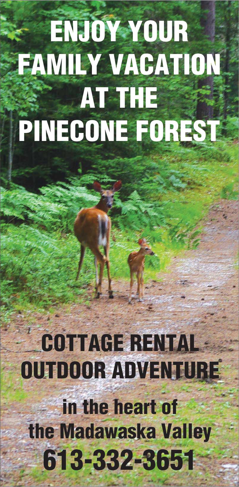
at The Pinecone Forest Nature Sanctuary. Copies of the maps were reprinted in Issue 66 of The Country Connection Magazine and are still available.
Copyright 2019
by Pinecone Publishing. All rights reserved.
|